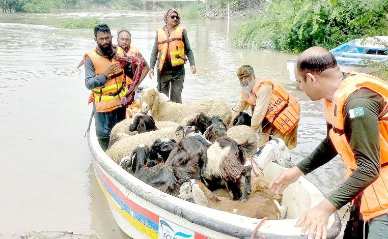
In high flood at Ganda Singh Wala, Sutlej inundates settlements

KASUR (A1tv News)River Sutlej was in high flood on Thursday morning as the authorities warned of further rise in water level with the inflow at Ganda Singh Wala – a border village in Kasur district recorded at 114,260 cusecs.
At least 20 villages have been disconnected from the nearby areas as the district administration intensified rescue efforts to save people and their cattle, establishing rescue camps at Chanda Singh, Mahi Wala and other villages.
Emergency Services Secretary Rizwan Naseer says 83 boats and over 300 rescue officials were currently operating in the flood-affected area after Caretaker Chief Minister Mohsin Naqvi ordered sending additional 55 boats and their operators from the districts adjoining Kasur.
On the other hand, water level is also rising at Sulemanki Headworks, located near Okara where both inflow and outflow currently stand at 62,118 cusecs. As a result, the deluge has started affecting the settlements along the river, destroying standing crops and forcing people to leave for safety.
Despite the claims made by the administration, the locals say no government official is visible in the area and they are moving to the safer locations on their own.
Earlier on Wednesday, the Met Office predicted more monsoon rains from today (Thursday) in different parts of the country, while the residents living along Sutlej were on the edge after a warning that the river might be in medium to high flood at Ganda Singh Wala during the next 24 to 28 hours.
It means India is going to release more water into the river because of persistent rains in the catchment areas. It was in 1988 that Pakistan had witnessed worst flooding in the two eastern rivers – Ravi and Sutlej – which devastated crops and livelihoods over hundreds of thousands of acres.
In this connection, the NDMA directed the authorities to concerned to continuously monitor the situation at Jassar – a border town of Narowal district where the first control structure on River Ravi in Pakistan is located – and Trimmu Barrage in Jhang district, which regulates the flow of River Chenab.
As far as the rainy spell is concerned, the Met Office says it will affect Pakistan from July 13 to 17 as monsoon currents from Arabian sea are likely to penetrate in upper and central parts of the country from July 12 (evening) which are likely to intensify on 14th.
Moreover, a westerly wave is also expected to enter upper parts on July 14 evening, meaning that the two systems, meaning that the interaction between the two systems could cause extreme weather events.
It said heavy rains might cause urban flooding in low-lying areas of Islamabad, Rawalpindi, Peshawar, Gujranwala and Lahore from July 14 to 17 as well as triggering landslides in Murree, Galliyat, Kashmir, Gilgit-Baltistan and Khyber Pakhtunkhwa during the period.
At the same time, farmers have been advised to manage their activities keeping in view the weather forecast while tourists and travelers should remain extra cautious to avoid any untoward situation.
Moreover, dust/wind storms may also damage loose structures like electric poles and solar panels as people are asked to stay at safe places during this situation.


